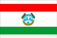
Harari Region (Harari Region)
 |
Based on the 2007 Census conducted by the Central Statistical Agency of Ethiopia (CSA), Harari has a total population of 183,415, of whom 92,316 were men and 91,099 women. This region is the only one in Ethiopia where the majority of its population lives in an urban area: 99,368 or 54.18% of the population are urban inhabitants. With an estimated area of 311.25 square kilometers, this region has an estimated density of 589.05 people per square kilometer. For the entire region 46,169 households were counted, which results in an average for the region of 3.9 persons to a household, with urban households having on average 3.4 and rural households 4.6 people. Ethnic groups in the region include the Oromo (56.41%), Amhara (22.77%), Harari (8.65%), Gurage (4.34%), Somali (3.87%), Tigray (1.53%), and Argobba (1.26%). Languages spoke include Oromiffa (56.84%), Amharic (27.53%), Harari (7.33%), Somali (3.70%), and Gurage (2.91%).
In the previous census, conducted in 1994, the region's population was reported to be 131,139, of whom 65,550 were men and 65,589 women. At the time of that census, 76,378 or 58.24% of the population lived in urban areas. Ethnic groups in the region recorded in the earlier census included the Oromo (47.1%), Amhara (50.7%), Harari (7.1%), Gurage (3.2%), Tigray (1.71%), and Somali (1.68%). Languages recorded included Oromiffa (72.79%), Amharic (22.97%), Harari (7.61%), Gurage (1.13%) and Tigrinya (1.13%)
According to the CSA,, 73.28% of the total population had access to safe drinking water, of whom 39.83% were rural inhabitants and 95.28% were urban. Values for other reported common indicators of the standard of living for the Harari region include the following: 5.7% of the inhabitants fall into the lowest wealth quintile; adult literacy for men is 78.4% and for women 54.9%; and the regional infant mortality rate is 66 infant deaths per 1,000 live births, which is less than the nationwide average of 77; at least half of these deaths occurred in the infants’ first month of life.
Map - Harari Region (Harari Region)
Map


Country - Ethiopia
 |
 |
| Flag of Ethiopia | |
Anatomically modern humans emerged from modern-day Ethiopia and set out to the Near East and elsewhere in the Middle Paleolithic period. Southwestern Ethiopia has been proposed as a possible homeland of the Afroasiatic language family. In 980 BCE, the Kingdom of D'mt extended its realm over Eritrea and the northern region of Ethiopia, while the Kingdom of Aksum maintained a unified civilization in the region for 900 years. Christianity was embraced by the kingdom in 330, and Islam arrived by the first Hijra in 615. After the collapse of Aksum in 960, a variety of kingdoms, largely tribal confederations, existed in the land of Ethiopia. The Zagwe dynasty ruled the north-central parts until being overthrown by Yekuno Amlak in 1270, inaugurating the Ethiopian Empire and the Solomonic dynasty, claimed descent from the biblical Solomon and Queen of Sheba under their son Menelik I. By the 14th century, the empire grew in prestige through territorial expansion and fighting against adjacent territories; most notably, the Ethiopian–Adal War (1529–1543) contributed to fragmentation of the empire, which ultimately fell under a decentralization known as Zemene Mesafint in the mid-18th century. Emperor Tewodros II ended Zemene Mesafint at the beginning of his reign in 1855, marking the reunification and modernization of Ethiopia.
Currency / Language
| ISO | Currency | Symbol | Significant figures |
|---|---|---|---|
| ETB | Ethiopian birr | Br | 2 |
| ISO | Language |
|---|---|
| AM | Amharic language |
| EN | English language |
| OM | Oromo language |
| SO | Somali language |
| TI | Tigrinya language |
